ROOT RIVER STATE BIKE TRAIL
Looking for a great place to spin your wheels?
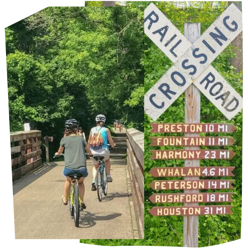
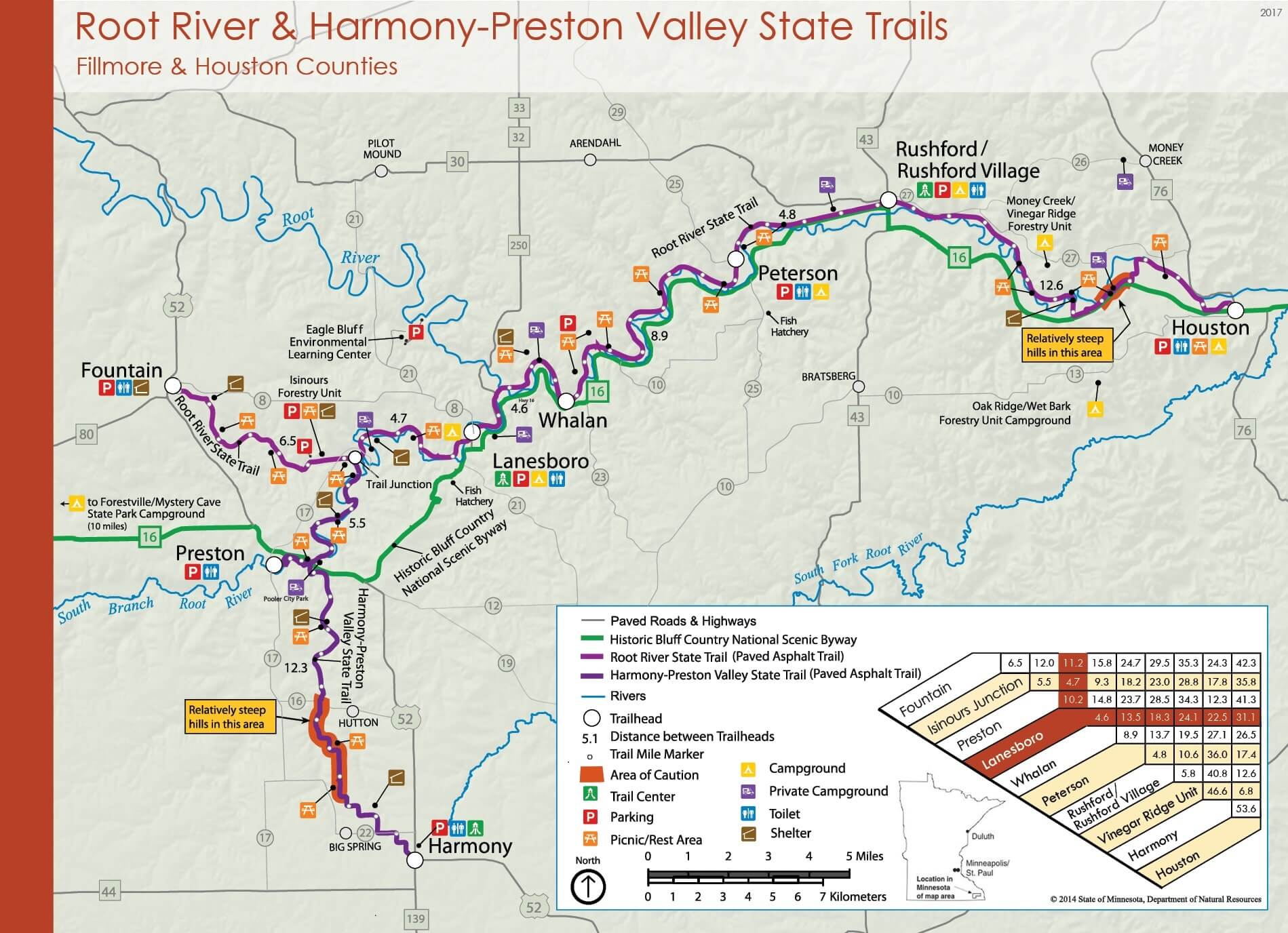
Biking lovers rave about the spectacular paved Root River State Trail that winds 42 miles through the valley with Lanesboro at its heart. It also connects up with the Harmony Preston Valley State Trail for an additional 18 paved miles.
🚵🏾♀️ Bike, Hike, Skate, and Ski Year-Round!
These trails run along an abandoned railroad bed through towering 300-foot limestone bluffs, forestlands, river, rolling fields and pure inspiration. Experience Fillmore County's rural landscape and abundant wildlife including wild turkeys, deer, hawks, and turkey vultures. Rattlesnakes can occasionally be found on rock outcrops, along the river bottoms, or sunning themselves on the trail.
Historical buildings and rural communities along the trail provide sites of interest as well as many services. Campgrounds, bed-and-breakfasts, restaurants, museums, outfitters and unique stores can be found in many of the trail towns. Cyclists, in-line skaters, hikers and cross-country skiers enjoy these premier trails year round!
Other Root River Trail resources:
ℹ️ Trail Information (FROM MN DNR)
The following trail information is from the Minnesota Department of Natural Resources Root River State Trail webpage.
LANDSCAPE
Part of the Blufflands Trail System, the trail provides outstanding views of the soaring limestone bluffs of the Root River Valley. The trail rises and falls with the bluffs, winding through historic towns tucked into hillsides, past rolling farm fields, milling districts, and relics of the railroad's heyday. Lush and verdant stretches offer views of the area's natural beauty.
Wildlife is abundant, and sightings of wild turkey, deer, hawks and turkey vultures are common. Rattlesnakes can occasionally be found on rock outcrops, along the river bottoms, or sunning themselves on the trail. They are a state threatened and protected species, and should be left alone.
Historical buildings and rural communities along the trail provide sites of interest as well as many services. Campgrounds, bed-and-breakfasts, restaurants, museums, outfitters and unique stores can be found in many of the trail towns.
RESTROOMS
Restroom facilities are available along the trail at these points:
- at the parking lots in Fountain and Peterson
- at the trail centers in Lanesboro, Rushford and Houston
WINTER
Cross-country skiing is popular on this trail in the winter. Most of the trail is groomed in the winter. There are 30 miles of set track from the Isinours Forest Recreation Area in Preston to the bridge outside of Houston. A Minnesota Ski Pass is required to ski on this trail. There is no snowmobiling on the trail, although the trail does briefly intersect with the Fillmore and Houston county Grants-in-Aid (GIA) trail system, which provides many miles of groomed snowmobile trails in the area.
PERMITS
You will need a Ski Pass for cross-country skiing. No other fees or passes are required to use the trail.
PARKING
Do not leave valuables in your vehicle!
Parking is available at the following trail accesses:
- Fountain: From Highway 52 take County Road 8 about one mile to the parking lot near the city park/softball field.
- Lanesboro: Parking is available in the lot next to the Bass Pond off of County Road 8. Additional parking is available along the streets and at the parking lot by the Community Center/Sylvan Park.
- Whalan: Street parking.
- Peterson: From Highway 16, turn into Peterson on Mill Street, go 1/2 mile to Fillmore Street, and turn left to the city campground/softball field. Parking is also available along the streets.
- Rushford: From Highway 16, turn north on Elm Street and go one block. The parking lot is at the restored railroad depot.
- Houston: Turn west on Plum street of of Highway 76 and go one block to the Nature Center.